The Role of a Georegistry in National Health Systems
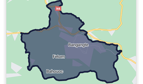
In any national digital infrastructure, maintaining an up-to-date geographic reference system is fundamental. Why? Because it enables more precise and efficient actions. In healthcare, geographic data supports vital objectives such as building national health maps, improving access to care, strategically planning investments, and microplanning vaccination campaigns to ensure that limited resources are used in the most effective way possible.
However, managing a geographic reference system like a national database of villages and localities is no simple task. It requires the ability to engage with local actors such as territorial administrations and health systems to capture changes and updates on the ground.
To address these challenges, Bluesquare has spent the past five years developing IASO, a powerful geodata management tool also known as a georegistry. Today, it’s recognized as a benchmark in the sector. IASO is actively used in over 14 countries (including Benin, Burkina Faso, Burundi, Cameroon, the Central African Republic, the Democratic Republic of Congo, Haiti, Côte d’Ivoire, Mali, Niger, Nigeria, Senegal, South Sudan, and Uganda) supporting georegistry management, health mapping, and digital microplanning of campaigns.
After several years of real-world implementation, we can now clearly identify the core features of a georegistry, that allow IASO to support even the most complex reference systems.
Reach out for more information: Contact
Feature 1: change requests
Effective georegistry management starts with accurate field data. But data quality can only be ensured if changes are verified and managed properly.
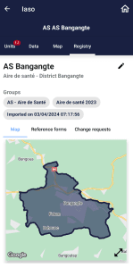
To meet this need, IASO allows local actors to submit change requests, such as when two villages merge into one locality. Through the IASO mobile app, territorial administrations and local health systems can view the geographic reference data relevant to their area and suggest updates when they notice changes on the ground.
Feature 2: streamlined validation workflow
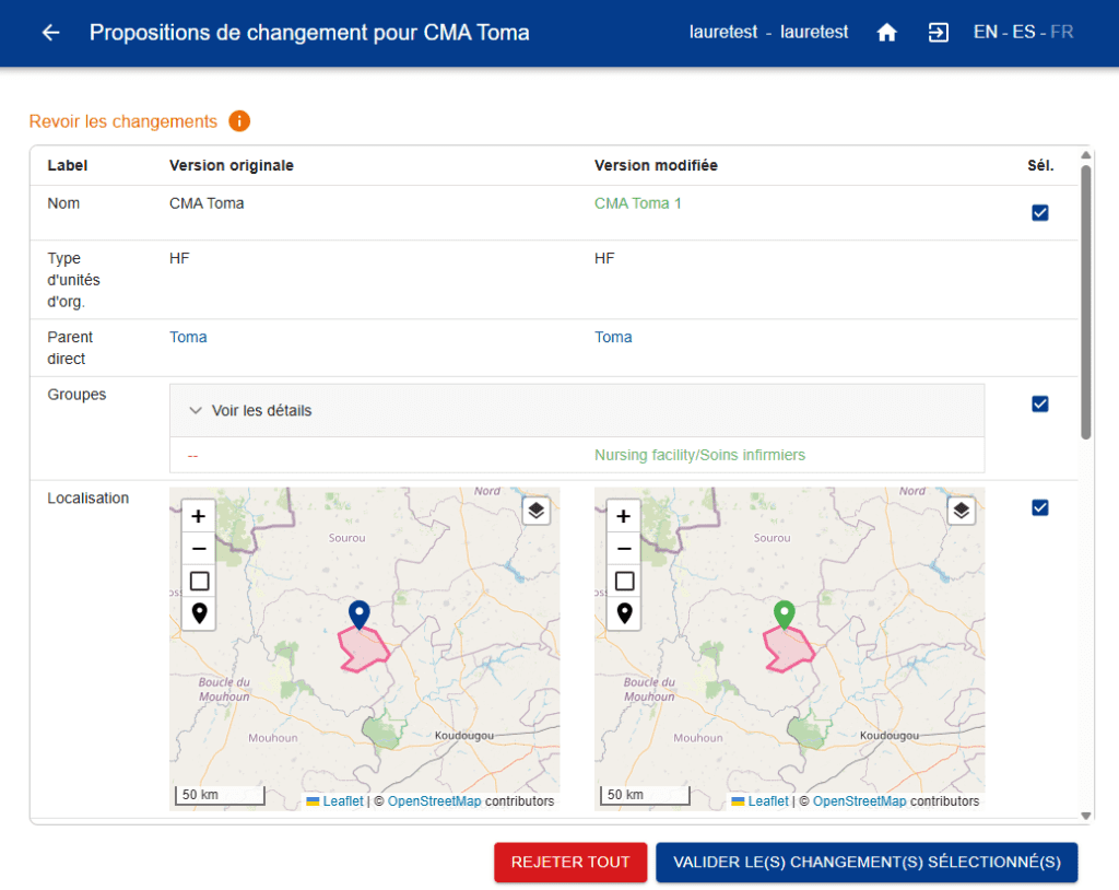
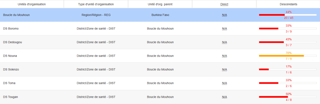
Once change requests are submitted, they are reviewed by designated approvers through a dedicated validation interface. This interface displays both the current version and the proposed update side by side, making it easy to compare and assess the change.
One of IASO’s strengths lies in its robust user management system, which enables a high level of decentralization. Each user can be restricted to a specific geographic area, ensuring that only the right people can validate changes within their scope.
This structure also allows for multi-level validation: for example, a change might first be approved at the regional level before being validated nationally.
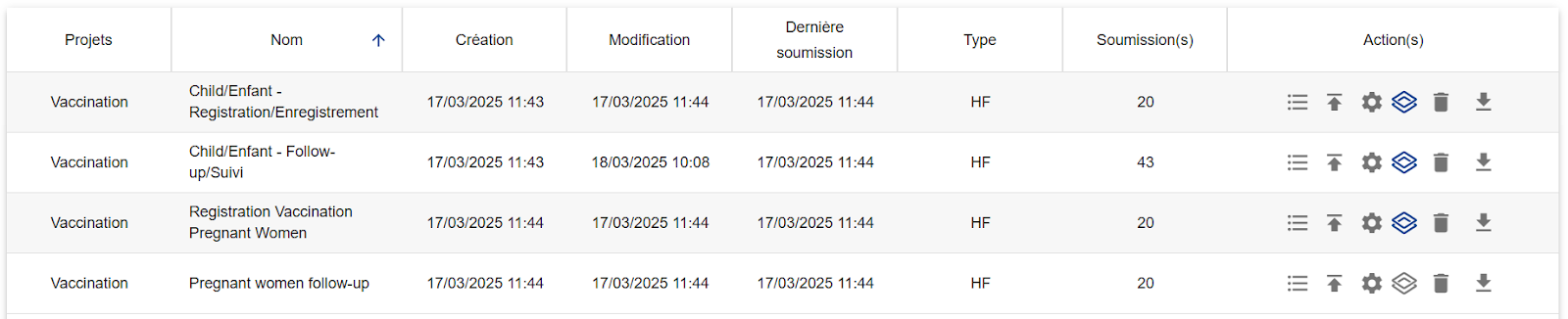
Feature 3: one georegistry, multiple projects
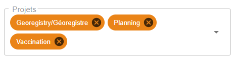
One of the reasons IASO has become such a successful georegistry is its flexible “project” structure. While the underlying geographic reference system is shared, IASO allows different technical teams to manage their own projects based on that common dataset.
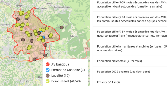
For instance, one team might manage the national village registry, another the health facility map, and yet another team might focus on creating and managing vaccination microplans.
IASO supports this by letting users create individual “projects,” each with its own dedicated user management and tailored interface. All these projects draw from and contribute to the same central georegistry, creating a virtuous cycle where each use case continuously improves the quality of the geographic reference data.
Feature 4: data workflow visualization and completeness tracking
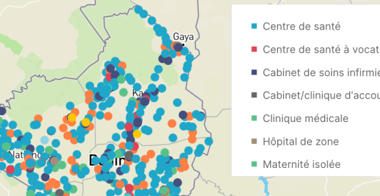
Managing a national geographic registry or health map involves contributions from a wide network of local actors. These contributors might update the assignment of villages to administrative or health zones, correct geographical boundaries, or describe health infrastructures like hospitals. IASO gives managers full visibility into who made each data update and when.
It also includes a task management system – known as planning – which allows supervisors to define tasks (e.g., verifying facility locations or updating health area boundaries), assign them to specific users, and track progress through the mobile interface.
For example: a task assigned to a health worker to update the health facility map for their district.
Feature 5: seamless DHIS2 integration
One final feature that has cemented IASO’s status as a go-to georegistry is its seamless integration with DHIS2, the widely used open-source platform for health and education data management.
IASO includes a built-in interface to connect directly with DHIS2, ensuring synchronization of the geographic reference data, also known in DHIS2 as the “org unit hierarchy.” This means IASO can serve as the master tool for managing and updating registries of villages, health facilities, or community health workers, with updates automatically pushed to connected DHIS2 instances.
For countries already using DHIS2, IASO is a valuable companion tool that enhances data accuracy, simplifies registry management, and improves coordination between stakeholders.
Reach out for more information: Contact