DHIS2 and IASO: complementary tools for data-driven projects
In many low- and middle-income countries (LMICs), DHIS2 has become the foundational software for national health management information systems. As an open-source platform, it plays a central role in how ministries of health collect, aggregate, and analyze data for policy and planning. Alongside DHIS2, another open-source solution—IASO—has gained traction in recent years. Developed by Bluesquare, IASO is a data collection platform with advanced geospatial capabilities. While originally focused on health programs, it can be used in other fields such as environmental management, climate change, education or social programmes.
Rather than competing with DHIS2, IASO was designed to complement and integrate with it. In fact, IASO was born in settings where DHIS2 was already widely used. Its development has been shaped by real-world needs in countries working to bridge gaps in field data collection, geographic precision, and mobile workflows. This foundational link between the two tools has made integration a priority from day one.
Deep integration and shared foundations
Bluesquare, the team behind IASO, has deep technical and operational knowledge of DHIS2. Over the last decade, it has led DHIS2 implementations across multiple countries and developed a suite of custom applications that extend its functionality. IASO benefits directly from this experience. It shares many conceptual elements with DHIS2, most notably the use of organizational units to structure geographic and administrative hierarchies.
Importantly, IASO is not a standalone system. It includes a built-in interface that allows users to map data elements between IASO and DHIS2, enabling bidirectional geographical data flows. This means data collected in the field through IASO can be pushed into DHIS2, and vice versa. This tight integration ensures that both tools can be used side by side without data loss or duplication.
Flexibility in form design
DHIS2 provides specialized form design tools tailored to different data collection methods: the Aggregate (Data Set) builder for indicator reporting, and the Tracker/Event designer for individual or case-based data capture. This dual-tool setup allows programs to leverage purpose-built widgets, validation features, and analytics tailored to their specific reporting needs — all supported by DHIS2’s community and ecosystem. However, this separation also means implementers must learn two distinct approaches, validation workflows, and design paradigms. As a result, many feel the need to extend DHIS2’s native capabilities through custom scripts or external form solutions.
IASO takes a different path, embracing a unified approach based on XLSForm — the spreadsheet-based standard popularized by ODK — for all types of data collection, whether for aggregated indicators or individual case records. XLSForm natively supports skip logic, conditional validation, cascading questions, and on-device calculations, all expressed in a familiar tabular format, commonly called “Excel sheet”. This “one format fits all” philosophy enables teams to prototype, refine, and share complex questionnaires efficiently, without switching between tools or conceptual models. The result is a more intuitive, flexible environment for designing sophisticated field data collection forms, and more autonomous non-technical teams.
Reach out for more information: Contact
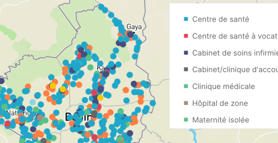
Advanced geospatial capabilities
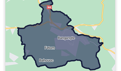
Geospatial data management is where IASO truly sets itself apart. It allows users to directly edit geographic data, such as updating boundaries or coordinates, with the option to introduce a validation loop for supervisory review. Unlike DHIS2, IASO can handle multiple geographic data sources in parallel, making it possible to compare different versions of administrative boundaries or facility lists within the same platform.
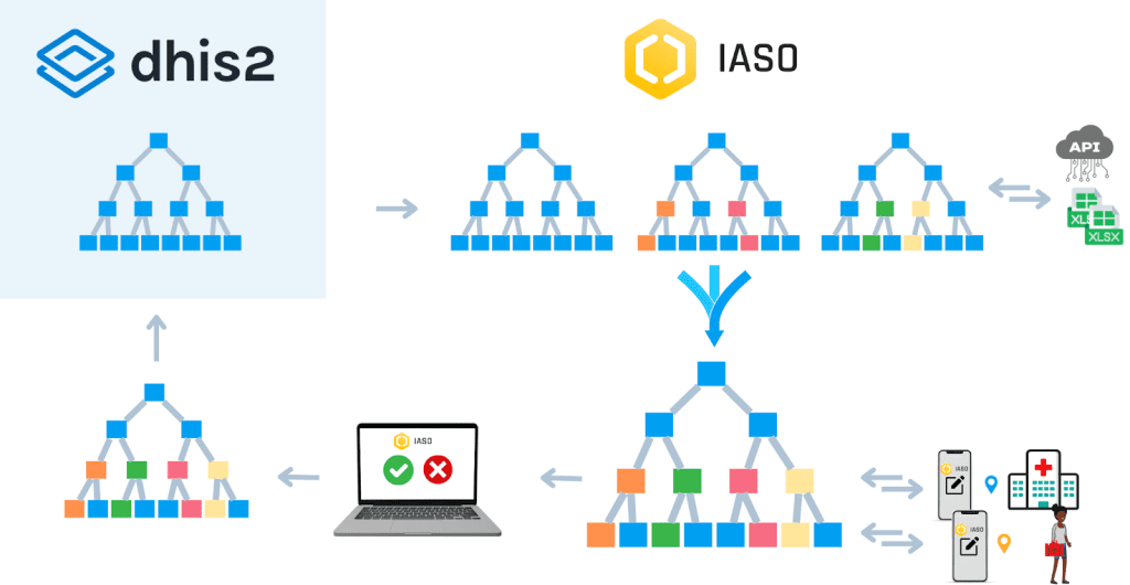
IASO also supports the import and export of GeoPackages, a standard format for geospatial data that includes both geometry and attributes. This makes it easier to associate GPS coordinates or shapefiles with specific organizational units. In situations where discrepancies are found between DHIS2 and IASO geographies, IASO can automatically detect and flag these differences, generating validation requests for supervisors to review and resolve—helping to keep systems’ geographic data aligned.
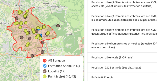
Geolocated data collection and planning
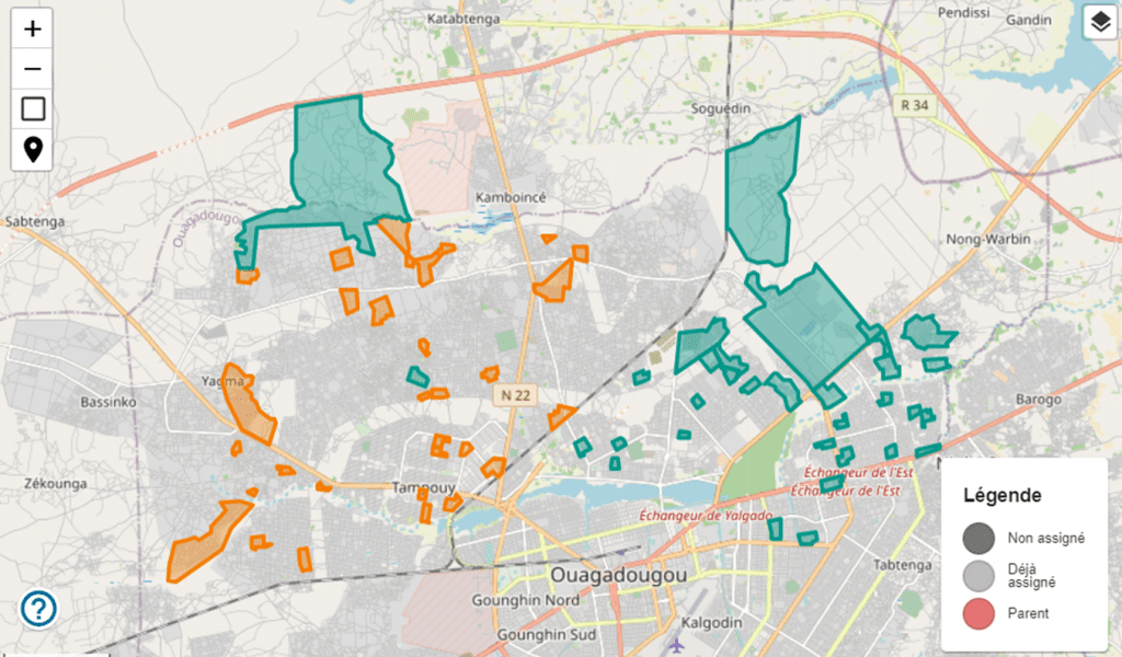
Beyond form design and mapping, IASO includes features that support field-level planning and monitoring. It enables project managers to assign specific locations and times for data collection, ensuring that mobile users are in the right place at the right time. Features like geofencing restrict data collection to predefined areas, while position enforcement can require a field agent’s device to verify its GPS location before allowing form submission.
These tools are particularly valuable in campaign-based settings, where coverage and data quality depend on careful coordination across dispersed teams. Whether for vaccination, nutrition, or vector control campaigns, IASO ensures that field operations are both trackable and accountable.

Version control and auditability
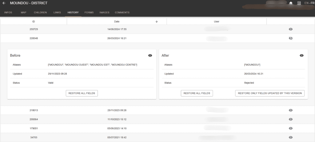
IASO includes built-in versioning for all key components of the system: forms, form submissions, and geographic data. This means that previous versions can be reviewed or restored if needed, providing a full audit trail. For organizations working in dynamic environments or running iterative campaigns, this ability to track changes over time is invaluable.
In contrast, DHIS2 does not currently provide native versioning for forms or data submissions, which can limit transparency in rapidly evolving projects.
Individual tracking and entity management
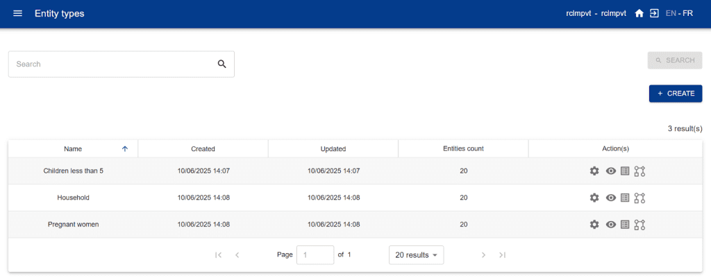
Both DHIS2 and IASO support individual-level data collection, which is essential for programs focused on case tracking, follow-up, or patient-level interventions. DHIS2 uses the Tracker module for this purpose, while IASO introduces the concept of entities—a flexible way to define and manage records linked to specific individuals, households, or other units of analysis, still using the XLS format for data collection.
This shared functionality allows projects to choose the platform that best fits their operational setup, while still aligning overall data strategy across tools.
Development models and responsiveness
Another point of differentiation lies in how the two platforms are developed and maintained. DHIS2 is the product of a global community effort led by the University of Oslo, which brings the benefit of wide consultation and long-term planning. However, this also means that feature development follows a fixed roadmap and may not always align with the urgent needs of specific projects.
IASO, while open source, is developed and maintained by Bluesquare’s in-house team. This allows for greater agility. If a client or country program urgently needs a new feature to meet a campaign deadline, the development team can prioritize and deliver it in time—something that can be challenging in more centralized systems.
Choosing the right tool—or using both
Ultimately, the decision to use DHIS2, IASO, or both depends on the context and goals of a given project. DHIS2 remains the go-to platform for national health reporting, integration with global indicators, and long-term health system strengthening. IASO is ideal for field-level deployment, complex data collection needs, and projects that rely heavily on geographic precision and mobile coordination.
Because the two platforms are designed to work together, teams do not need to choose one over the other. With thoughtful integration and support from experts who understand both tools, like Bluesquare, organizations can create powerful, adaptable data ecosystems that respond to both national priorities and local realities.
Reach out for more information: Contact