IASO is an open-source georegistry (sometimes spelled geo-registry) and geographic data management platform designed to serve as a reliable reference for health-related geographic entities. It supports the creation, maintenance, and governance of administrative boundaries, health facilities, villages, and other operational units that form the backbone of health information systems and public health operations.
IASO is the official georegistry tool for the Ministry of Health in Burkina Faso, where it is used to manage and maintain the national health georegistry.
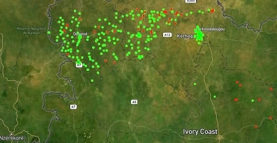
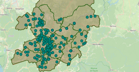
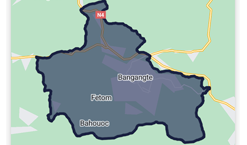
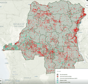
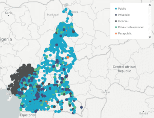
Beyond this national deployment, IASO has been used – and continues to be used – for large-scale health facility mapping and geographic data management projects in Democratic Republic of the Congo, Niger, Cameroon, and Benin. In these contexts, IASO supports the long-term maintenance of facility registries and administrative boundaries beyond one-off mapping exercises, ensuring that geographic data remains usable for routine systems, campaigns, and planning activities.
A structured and authoritative geographic reference
IASO enables countries and programs to build and maintain a single, authoritative geographic reference while accommodating the reality of fragmented and evolving data sources. Multiple datasets – originating from different institutions, projects, or time periods – can be imported, compared, reconciled, and consolidated into a master registry. Versioning mechanisms ensure that changes over time are fully traceable, making it possible to understand how geographic structures evolve and how historical data should be interpreted.
The platform is designed to handle complex hierarchies and frequent updates, including boundary changes, facility openings or closures, and administrative reorganizations. This makes IASO particularly well suited for national-scale georegistries that must remain accurate over long periods.
Field-to-central workflows for geographic data maintenance
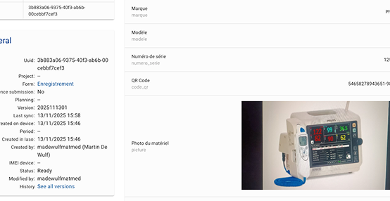
IASO supports end-to-end workflows for geographic data maintenance, from local data collection to central validation. Field teams and local authorities can submit updates using mobile data collection tools, including requests to create, modify, or deactivate geographic entities. These submissions are reviewed through structured validation workflows, ensuring that changes are verified before being incorporated into the official registry.
This approach strengthens data ownership at local level while preserving national oversight and data quality. Program managers gain visibility into pending updates, data completeness, and geographic coverage, helping prioritize corrective actions where needed.
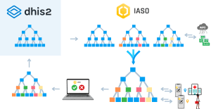
Designed to complement DHIS2
IASO is not a replacement for routine health information systems, but a complementary geospatial backbone. While DHIS2 focuses on health data collection, aggregation, and analysis, IASO specializes in managing the geographic entities that those data rely on.
IASO allows direct editing of geographic features, parallel handling of multiple source datasets, and advanced geospatial operations that are outside the scope of DHIS2. Built-in interoperability mechanisms enable synchronization of organizational hierarchies and geographic references with DHIS2 instances, ensuring consistency between systems while allowing each platform to focus on what it does best.
A foundation for planning, campaigns, and analysis
By providing a shared and reliable geographic backbone, IASO enables more precise microplanning, improved data integration across systems, and better analysis of health coverage and service delivery. Whether used for routine health systems, surveys, or vaccination campaigns, IASO helps ensure that decisions are grounded in accurate, up-to-date geographic reality – down to the last mile.