In today’s global economy, the ability to prove where a product comes from is no longer a luxury—it is a fundamental requirement for market access and consumer trust. Whether it is a batch of sustainably farmed coffee or a plot of land for carbon sequestration, data traceability ensures that every link in the supply chain is documented and verifiable. IASO provides a robust, open-source solution that bridges the gap between field activities and digital registries, reporting data even in the most remote areas where connectivity is not possible. It enables organizations to optimize their operations while meeting the highest standards of transparency and sustainability.

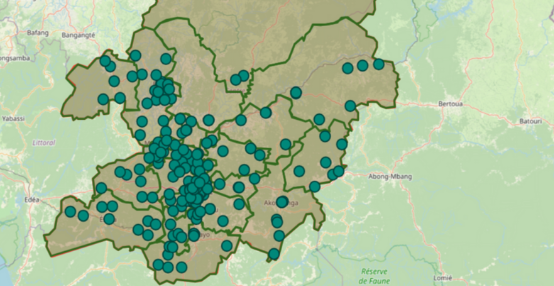
Farm mapping in Burkina Faso
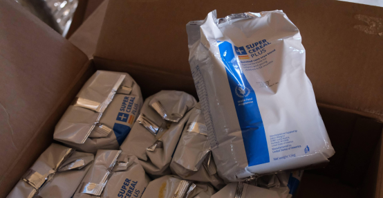
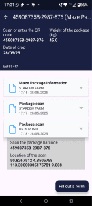
Optimizing the agricultural and forestry supply chain
True traceability begins with a precise digital representation of physical assets. IASO allows organizations to move beyond aggregate data by tracking individual items such as specific trees, crop parcels, or pieces of infrastructure. This granular approach helps identify inefficiencies in real-time, reducing losses and ensuring that high-quality standards are maintained throughout the value chain.
Granular asset management and parcel monitoring
Traceability is only as good as the precision of its source data. IASO’s advanced geospatial data management enables the tracking of physical assets based on exact georeferencing. In sectors like forestry, this means monitoring individual tree growth and health over years. For agricultural cooperatives, it involves the precise mapping of smallholder parcels. By digitizing these assets, managers can automate monitoring workflows, ensuring that environmental indicators trigger necessary field actions immediately.
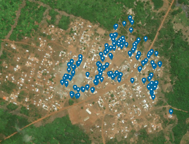
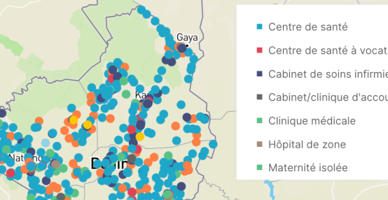
Management of entities based on geospatial referencing
Digital microplanning for operational excellence
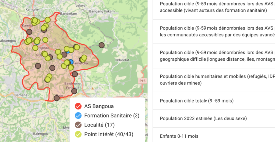
Managing field teams across remote agricultural or forest landscapes often leads to coordination gaps and “ghost” data. IASO addresses this through digital microplanning, which replaces scattered manual records with a real-time platform. Managers can assign geographic points to specific users, ensuring full coverage of a targeted area. This level of organization not only boosts productivity but also creates an unshakeable audit trail of who visited which location and when, which is essential for certification processes.
Driving sustainability and ESG (environmental, social and governance) transparency
For organizations focused on environmental impact, such as those in carbon removal or sustainable forestry, data traceability is the foundation of their credibility. Proving that a carbon credit represents a real, standing tree requires a transparent and verifiable data history. IASO facilitates this by creating a permanent link between field-collected data and central analytics platforms, ensuring that sustainability claims are backed by scientific evidence.
Bridging the gap with offline GIS capabilities
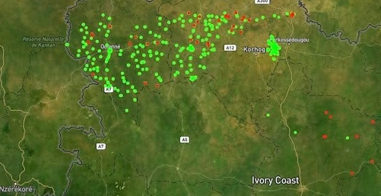
Sustainable development often happens in areas with limited or no internet connectivity. Many traditional GIS (Geographic Information System) platforms struggle in these environments, leading to data delays and inaccuracies. IASO is specifically designed for the field reality, offering stronger offline GIS capabilities than generic data collection tools. Field agents can collect data, navigate complex terrains, and record observations offline; once a connection is established, the information is synced to a centralized registry, maintaining a continuous and reliable data flow from the most remote locations.
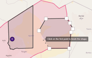
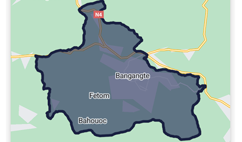
Creating detailed and accurate parcels
Interoperability and real-time impact visualization
Traceability data should not exist in a vacuum. IASO prioritizes interoperability and open data standards, allowing for seamless integration with existing systems or advanced analytical engines like OpenHEXA. This connectivity enables the creation of real-time dashboards that visualize environmental impact and supply chain health. Organizations can monitor key indicators, such as reforestation rates or distribution transparency, allowing them to report to investors and regulators with total confidence.
Proven impact in large-scale data management
The scalability of IASO is demonstrated by its success in handling massive datasets in complex environments. For instance, in health campaigns where tracking individual beneficiaries is crucial, the platform has managed the registration of millions of households. This same technical rigor is applied to asset tracking in agriculture and environment, ensuring that even the most complex supply chains remain transparent. By empowering local stakeholders with training and sustainable tools, Bluesquare ensures that data traceability becomes a long-term asset for national and private organizations alike.