IASO for farms mapping and agriculture products traceability

November 25, 2025

Agricultural value chains—especially those linked to export markets—are undergoing major pressure. Smallholder farmers face volatile demand, tightening regulatory environments, and declining support from traditional development partners. The upcoming EU Deforestation Regulation (EUDR) adds new documentation, geolocation, and traceability requirements that many existing systems cannot meet affordably or reliably. 

Discover how IASO, Bluesquare’s geospatial data platform, provides an adaptable foundation for building agriculture-focused data systems that meet these traceability and compliance needs.

Leveraging IASO’s strengths in precise geolocation, field-level registries, data collection, workflows, and open APIs, agriculture programs can build robust, extensible solutions for farm registration, compliance tracking, and supply-chain traceability.

Farm and Field Registry

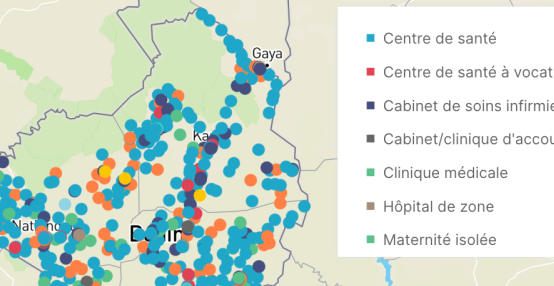
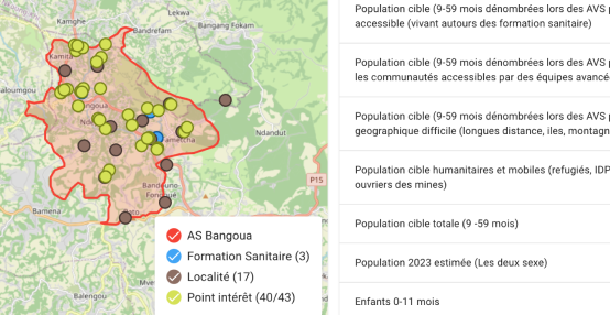
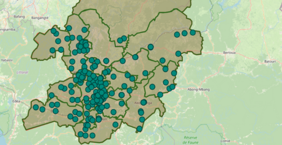
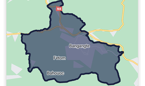
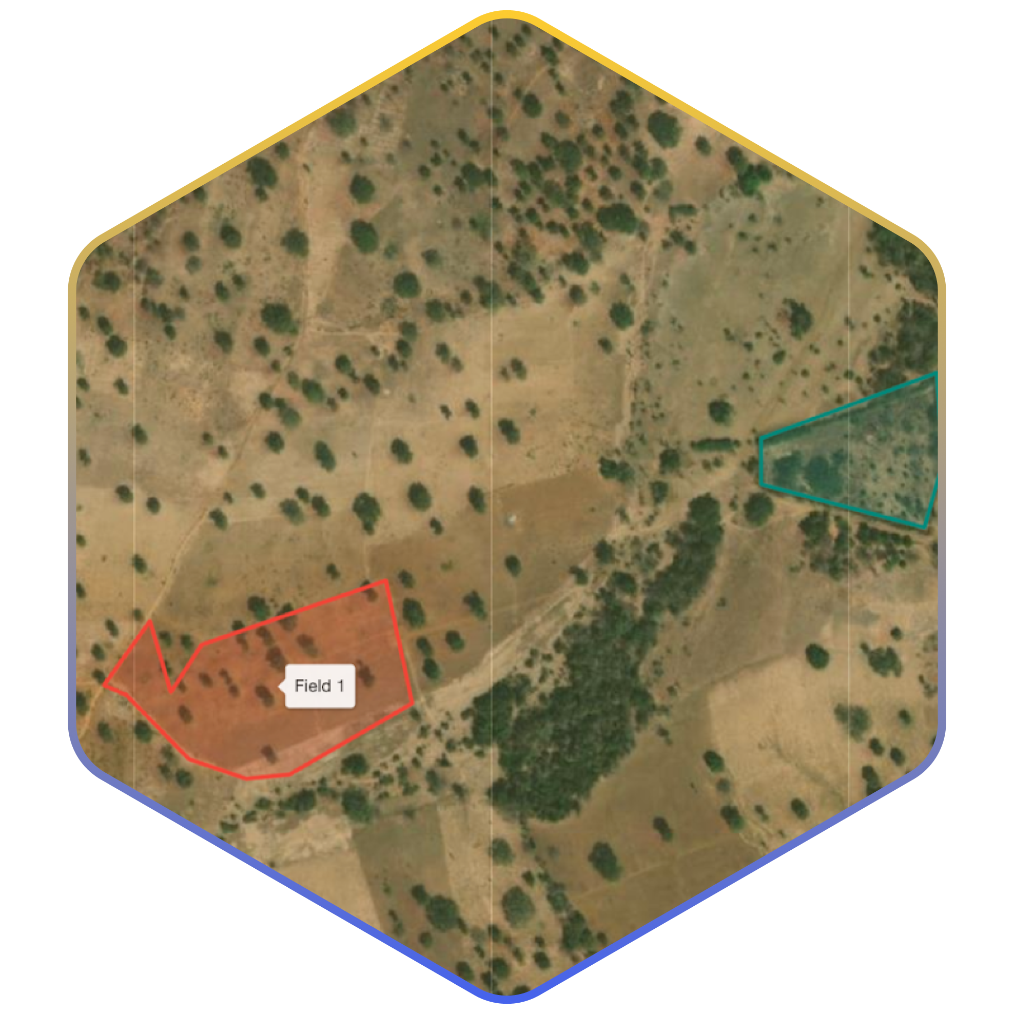
IASO creates a structured registry of farms and fields. Each farm is mapped with precise GPS coordinates, and associated fields are drawn as polygons or captured as points. 

Registration happens through mobile devices that work both online and offline. Field agents or farmers can capture boundaries, photos, and supporting documents. Updates (such as new plots or changing cultivation practices) are pushed directly to the central registry.

This provides a unified system of record that can be shared with traders, exporters, and regulatory authorities. 

Traceability of Produce and Logistics

IASO can be configured to support item-level or batch-level tracking along agricultural supply chains:

  • Mobile data collection with timestamped and geolocated entries.
  • Packaging or batch identification through QR codes for field-to-export traceability.
  • Digital tracking of movement from farm → collection point → processing → export.

This enables exporters to provide verifiable supply-chain histories that satisfy buyer and regulatory requirements.


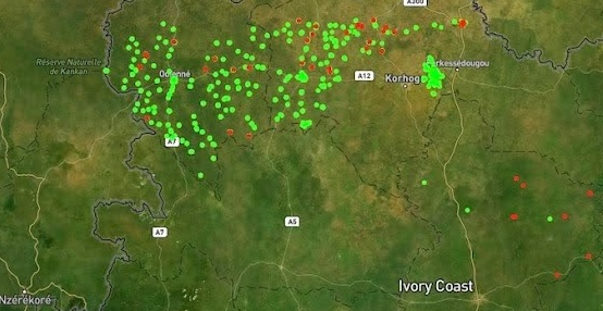
Integrating satellite imagery and external datasets

Through OpenHEXA, IASO connects with satellite imagery and other geospatial datasets. Analysts can detect land-use change, verify compliance, calculate area statistics or merge multiple data sources to support audit processes or buyer reporting.

For advanced data pipelines, processing, and analytics, IASO integrates seamlessly with OpenHEXA.

Use cases include:

  • Automated data transfer from IASO to analytical tools (e.g., Power BI).
  • Integration of satellite imagery for deforestation verification.
  • Merging farm registries with trader or exporter datasets.
  • Running geospatial analyses (e.g., accessibility, land-cover classification).
  • Creating dashboards for government agencies or private-sector partners.

Want to learn more about IASO? Contact us

Trusted by

IASO has become a trusted name for health data management with implementations in 15 countries and two large-scale multi-country projects, in support to the Global Polio Eradication Initiative and UN nutrition programs.
  • World Health Organization
  • The World Bank
    The World Bank
  • USAID
  • PMI logo
    U.S. President's Malaria Initiative
  • Unicef
  • GAVI logo
    Gavi
  • Gates Foundation
  • Clinton Health Access Initiative
  • Cordaid
  • Lifenet logo
    Lifenet international
  • Abt Associates
    Abt Associates
  • Centre for Humanitarian Dialogue
    Centre for Humanitarian Dialogue
  • SANRU - Soins de Santé primaires en milieu Rural (DRC)
    SANRU - Soins de Santé primaires en milieu Rural (DRC)
  • Cameroon Expanded Programme on Immunization
    Cameroon Expanded Programme On Immunisation
  • Ministry of Health Burkina Faso
    Burkina Faso Ministry of Health
  • Cote d'Ivoire Malaria National Programme
    Cote d'Ivoire Malaria National Programme
  • Democratic Republic of Congo Ministry of Health
    Democratic Republic of Congo Ministry of Health
  • Niger Ministry of Health
    Niger Ministry of Health

Latest about IASO

IASO provides a comprehensive and flexible solution for agricultural data management. Its geospatially-enabled architecture, mobile data collection, traceability features and integration capabilities make it well-suited to meet the evolving requirements of agricultural markets and regulatory frameworks.

IASO can be used to create a complete and up-to-date registry of medical equipment. This tool makes it possible to record, track, and analyze all events related to each device. With its flexible data model, mobile application, and configurable workflows, IASO offers an adaptable solution for inventory, maintenance, planning, and oversight of medical equipment—at both local and national levels.

Along with its form-based approach to data collection, IASO has an advanced geospatial data management allowing for decentralization of responsibilities and task planning according to geography, as well as powerful map-based visualizations.

DHIS2 is the world’s most widely used platform for national health information systems. IASO builds on its foundation and adds agility, field-level precision, and advanced workflows needed for complex operational contexts. Learn more about the differences and complementarities of these two platforms.

In fields like public health, access to comprehensive geographic data is crucial for designing targeted and effective interventions. That’s exactly the need Bluesquare set out to meet with IASO, its geographic data management platform now rolled out in 14 countries. Let’s dive into the 5 essential features that make IASO a go-to georegistry solution.

Ready to get started

Get started

Request demo account

Fill out the information below to create a IASO demo account. You will receive an email with temporary credentials.